

Global News
- Details
- Category: Global News
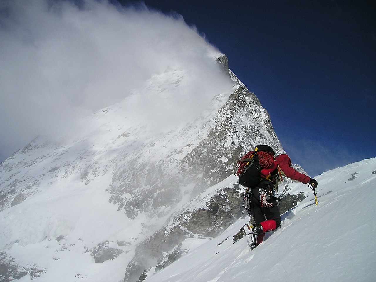
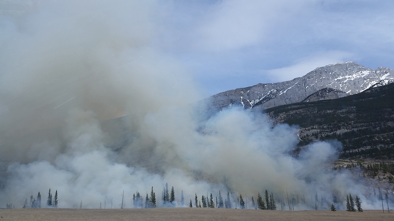
A unique project is linking in-situ measurements with natural hazard research. For the past ten years, a network of wireless sensors on the Matterhorn’s Hörnli ridge has been constantly streaming measurement data on the condition of steep rock faces, permafrost, and prevailing climate. The project leader, Jan Beutel, reviews progress to date.
The summer heatwave of 2003 triggered a rockfall that shocked both researchers and the general public: 1,500 cubic metres of rock broke away from the Hörnli ridge – a volume roughly equivalent to two houses. The fracture event exposed bare ice on the surface of the steep scarp. Experts soon realised that the record temperatures had warmed the rock down to such a depth that the ice contained in its pores and fissures had melted. This effectively caused a sudden reduction of the bonding holding the rock mass together.
- Details
- Category: Global News
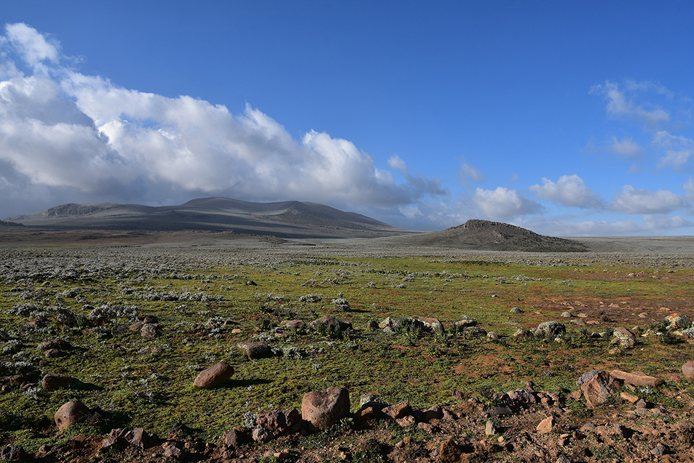
A rock overhang at almost 3500 meters in today's Ethiopia was permanently settled by Stone Age hunters over 40,000 years ago – making it the oldest known prehistoric dwelling in a high mountain range. This is according to a new study published in the journal Science.
The Bale Mountains are a mountain range in southern Ethiopia whose peaks reach heights of up to 4300 meters. This large Afro-alpine ecosystem is considered relatively pristine; the mountains were believed to have only recently been colonized. However, according to a new study conducted by an international and interdisciplinary research group, hunters settled permanently in this area during the last glacial period some 40,000 years ago. By analyzing the environmental and climatic conditions in the region, experts in archeology, soil science, geography, geology, and biology were able to prove that glaciers were located near the former settlement area in the Bale Mountains. The research team was also able to show, based on archaeological discoveries, that these Stone Age settlers made obsidian tools and fed on giant mole-rats.
- Details
- Category: Global News
New research has found that in contrast to pre-industrial climate fluctuations, current anthropogenic climate change is occurring across the whole world at the same time. In addition, the speed of global warming is higher than it has been in at least 2,000 years.
Many people have a clear picture of the 'Little Ice Age' (from approx. 1300 to 1850). It is characterized by paintings showing people skating on Dutch canals and glaciers advancing far into the alpine valleys. That it was extraordinarily cool in Europe for several centuries is proven by a large number of temperature reconstructions using tree rings, for example, not just by historical paintings. As there are also similar reconstructions for North America, it was assumed that the 'Little Ice Age' and the similarly famous 'Medieval Warm Period' (approx. 700–1400) were global phenomena. But now an international group led by Raphael Neukom of the Oeschger Center for Climate Change Research at the University of Bern is painting a very different picture of these alleged global climate fluctuations. In a study which has just appeared in the well-known scientific journal Nature, and in a supplementary publication in Nature Geoscience, the team shows that there is no evidence that there were uniform warm and cold periods across the globe over the last 2,000 years.
- Details
- Category: Global News
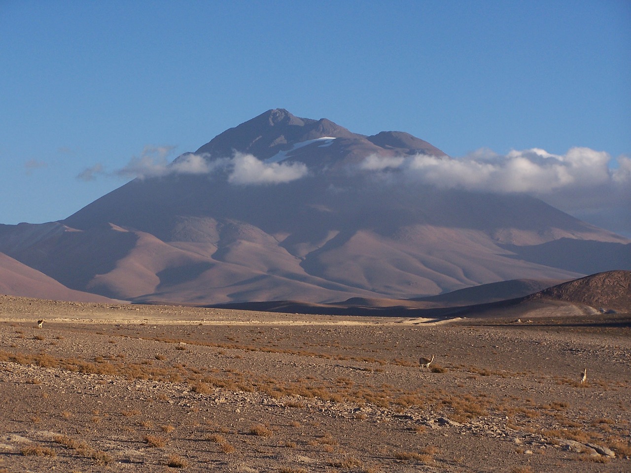
High in the Andes Mountains, dagger-shaped ice spires house thriving microbial communities, offering an oasis for life in one of Earth’s harshest environments.
The distinctive icy blade formations known as nieves penitentes (or, 'penitent ones') are named for their resemblance to praying monks in white robes and form in cold, dry conditions at elevations above 13,000 feet. The penitentes, which can range from a few inches to 15 feet high, are found in some of the most hostile conditions on Earth, with extreme winds, temperature fluctuations, and high UV radiation exposure due to the thin atmosphere.
- Details
- Category: Global News
In May, the UN Office for Disaster Risk Reduction published its Global Assessment Report on Disaster Risk Reduction 2019. This comprehensive analysis of disaster risk and risk management highlighted how threats such as air pollution, diseases, earthquakes, drought, and climate change can feed off each other, exacerbating the impact on human health and the environment. But what does this report mean for mountains? To find out, we spoke to disaster risk researcher and MRI SLC member Prof. Irasema Alcántara-Ayala.
Every two years, the UN Office for Disaster Risk Reduction (UNDRR) undertakes a global assessment of disaster risk reduction, highlighting emerging trends, revealing disturbing patterns, examining behaviour, and presenting progress in risk reduction. The results of this assessment form the basis of the Global Assessment Report on Disaster Risk Reduction, the aim of which is to focus international attention on the issue of disaster risk and encourage political and economic support for disaster risk reduction.
- Details
- Category: Global News
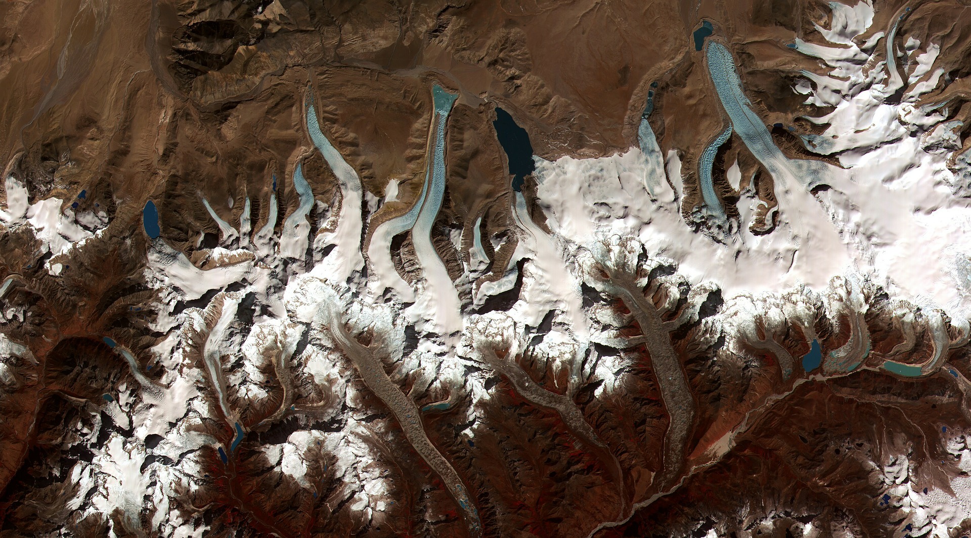
Using declassified images taken by Cold War spy satellites in the 1970s, researchers have revealed the dramatic extent of ice loss in the Himalayan glaciers over the last 40 years.
A new study published in Science Advances shows that the melting of Himalayan glaciers caused by rising temperatures has accelerated dramatically since the start of the 21st century. The analysis, spanning 40 years of satellite observations across India, China, Nepal, and Bhutan, indicates that glaciers have been losing the equivalent of more than a vertical foot and half of ice each year since 2000 — double the amount of melting that took place from 1975 to 2000. The study is the latest indication that climate change is eating away at the Himalayan glaciers, potentially threatening water supplies for hundreds of millions of people downstream across much of Asia.
- Details
- Category: Global News
In May, IPBES published its first Global Assessment. This marked the most comprehensive intergovernmental assessment of its kind. The results were alarming, with over a million species threatened with extinction, many within decades. We spoke to two mountain experts – Andreas Heinimann, an MRI Co-PI and one of the lead-authors of the Global Assessment, and Eva Spehn from IPBES Switzerland and the Global Mountain Biodiversity Assessment – about the importance of the results and the key message in the context of mountains.
Compiled by 145 expert authors from 50 countries over the past three years, with input from another 310 contributing authors, the IPBES Global Assessment Report on Biodiversity and Ecosystem Services assesses changes over the past five decades, providing a comprehensive picture of the relationship between economic development pathways and their impacts on nature. It also offers a range of possible scenarios for the coming decades.
- Details
- Category: Global News
Ice is without doubt one of the first casualties of climate change, but the effects of our warming world are not only limited to ice melting on Earth’s surface. Ground that has been frozen for thousands of years is also thawing, adding to the climate crisis and causing immediate problems for local communities.
In Earth’s cold regions, much of the sub-surface ground is frozen. Permafrost is frozen soil, rock or sediment – sometimes hundreds of metres thick. To be classified as permafrost, the ground has to have been frozen for at least two years, but much of the sub-surface ground in the polar regions has remained frozen since the last ice age.
