

In the past weeks GEO-GNOME has been actively connecting with the Group on Earth Observations' flagship activity Biodiversity Observation Network (GEO BON) by participating and presenting at the recent GEO BON Open Science Conference and All Hands Meeting. In the closing session of the conference, the five grantees under the GEO BON - Microsoft Call “EBVs on the cloud” were announced, with GEO-GNOME among them. The grant provides funding and computing capacity to further develop ecosystem level Essential Biodiversity Variables for mountains.
GEO BON Open Science Conference
GEO BON Open Science Conference was organized in a fully virtual format between 6-10 July 2020, gathering almost 500 participants from GEO BON and its partnering organisations. The week was packed with conference sessions highlighting the current work of the national, regional and thematic BONs and the GEO BON Working Groups as well as All Hands Meetings where specific groups met to discuss their current progress and future plans.
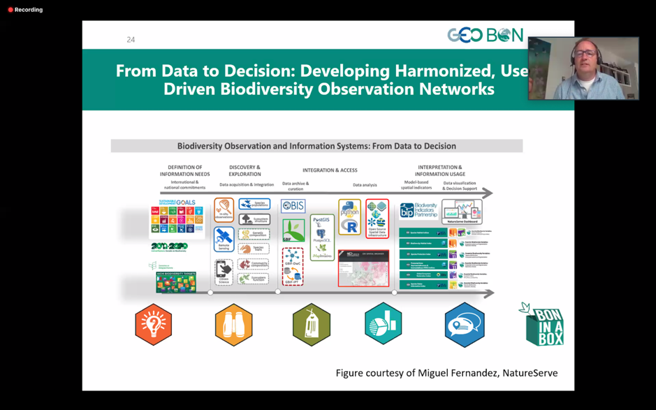
One of the key topics discussed over the week was how GEO BON can contribute to the ongoing process towards the Post-2020 Global Biodiversity Framework, and the possible support and products that were discussed especially in the key notes sessions and Policy Task Force Meetings. GEO BON plans on publishing a Hand Book on EBVs which will include chapters from each working group and BON. This book will be open source and published for the COP 15 of the UN Convention on Biological Diversity (CBD) in spring 2021 providing important content for decision makers but also other stakeholders responsible for the data collection at different levels.
Aino Kulonen from the MRI Coordination Office presented GEO-GNOME at the BON Development session on Tuesday afternoon. The aim was to inform the GEO BON community about the GEO-GNOME work on Essential Mountain Variables where Essential Biodiversity Variables (EBVs) present one element in the framework needed to understand and monitor mountain social-ecological systems, a key topic and outcome of the GEO-GNOME workshop held in Zurich earlier this year. During the closing session it was also pleasing to hear how several GEO BON working groups stressed the importance of getting out of their silos and connecting more with other networks and initiatives.
It was a pleasure for MRI and GEO GNOME to participate at this meeting, and we look forward to engaging more with GEO BON Working Groups and BONs in support of GEO GNOME’s work on EVs for mountains. We would also like to thank and congratulate the conference organisers who despite the shift to a virtual format managed to provide a smoothly run meeting with an open and enthusiastic atmosphere – well done!
Learn more about the conference here.
 GEO-GNOME success at GEO BON & Microsoft Call – EBVs on the cloud
GEO-GNOME is delighted to announce that our recently submitted proposal to the 1st GEO BON - Microsoft Joint Call was one of five which will receive funding!
The demonstration project, to be led by Eurac Research and the USGS with supporting contributions from the Mountain Research Initiative (MRI) and the Italian National Research Council (CNR), seeks to explore the potential of a combination of high-resolution remotely sensed data and sophisticated data-driven algorithms to both evaluate and enhance the spatial resolution of existing ecosystem maps in global mountainous regions.
This represents an outstanding opportunity to bring together expertise in ecosystem mapping, remote sensing and machine learning to improve datasets with extremely high policy relevance. More specifically, it is hoped that consistent time-series of maps will result from the project, providing insight into changes in ecosystem extents and fragmentation, whether they be due to climatic changes or more direct anthropogenic interventions, in several global mountain regions.
Thanks to the support of the project funders and partners, the project team will be able to take advantage of Microsoft’s Azure cloud infrastructure for computationally intensive tasks, as well as the spatial analysis and presentation capabilities offered by ESRI’s GIS software.
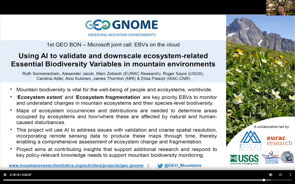 Bonnie Lei from Microsoft announcing the grantees of the “EBVs on the cloud” call
