Hiking for science: hydrological research at the Páramo of Chirripó, Costa Rica
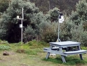
[caption id="attachment_3902" align="alignright" width="300"] Weather stations installed at the Base Crestones shelter
Written by Germain Esquivel-Hernández, Associate Professor at the School of Chemistry of the National University in Costa Rica.
Restricted to the latitudinal zone between the parallels of 11°N and 8°S, the Páramo is a key mountainous tropical ecosystem in South America because of the environmental services it provides, including high water production and carbon storage capacity. However, the so-called 'Isthmian Páramo' situated in Costa Rica and Panama remains understudied due to its remote location, compared to some of the better understood Páramo areas in South America. Here, I share how I embarked on a scientific journey to reveal the water secrets of the most extensive Páramo region in Central America: Chirripó.
Chirripó is a national park with an extension of about 100 km2, situated in the Talamanca Range (southern Costa Rica), where approximately 30 lakes of glacial origin are found. Visiting Chirripó is not an easy task. The intrepid adventurer must walk around 14.5 km (or 9 miles), with an elevation gain of about 2,000 m, to reach the shelter known as Base Crestones. A journey to the shelter can take up to 8 hours and most people start hiking early in the morning (around 2:00 am). Therefore, Chirripó is generally visited only by the most intrepid hikers who want to reach the highest point in Costa Rica, the Chirripó massif (3,820 m a.s.l.).
[caption id="attachment_3896" align="alignleft" width="400"]
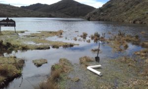
 Getting ready for the installation of a temperature sensor in Lake Ditkevi (or “Laguna Ditkevi” in Spanish)
I started working at Chirripó in April 2015 as part of my PhD project. Through this project, I was eager to unravel the water secrets of this fascinating setting of lakes and streams. My first challenge was to register the meteorological conditions at Chirripó. At the time we started our project, no good internet connection and electricity supply was available at the shelter. I therefore decided to install a manual weather station, operated by batteries, and involved the park rangers in my project by asking them to record the registers manually. However, the major challenge I faced was the collection of stream and lake water samples. To accomplish this task, I was limited to selecting only the three major lake systems and the streams feeding them to carry out seasonal monitoring surveys. I visited the lakes every three months. To collect samples, I needed to hike about 18 km (11 miles) across the park, reaching up to 3,700 m a.s.l. after crossing the continental divide twice.
A few years later, after having discovered some of the hidden secrets of this wonderful site, Chirripó has become regular part of my life. Today, I continue conducting research at this Páramo site, and I am glad to inform you that now there is an automatic weather station, so real time data of the meteorological conditions at Chirripó is directly transmitted to my office in Heredia. I am also happy to continue collecting water samples, to add to the around 500 I have already collected (with no little, but also very rewarding efforts!) since the beginning of this magical journey.
You are invited to discover the latest findings at Chirripó here.
Related Posts
By accepting you will be accessing a service provided by a third-party external to https://mountainresearchinitiative.org/


